Cart'OOo
|
Démonstration |
Cart'OOo
|
Démonstration |
VERSION 09.12 de Décembre 2009
815 CARTES vectorielles : 750 de Géographie & 65 d’ Histoire & 137 outils objets divers
| ORGANISATION & CLASSEMENT de la « GALLERY » Principe = Classement alphabétique : -Carto 1 à 4 : Outils de cartographie (glisser/déposer) -01 à 32 = CARTES VECTORIELLES de GEO par CONTINENTS / grandes Régions des continents / Etats alphabétiques -33 à 36 = CARTES VECTORIELLES d'HISTOIRE |
LEGENDE L Limites (Line) => littoraux & frontières (coasts & boundaries ) LI Limites Intérieures (Line In) =>Régions Départements Provinces Cantons Districts Comtés ...) H Hydrographie (Hydrography) C Villes Cities chaque carte possède un code : L / Li / LH / LIH / LIC ..... |
 | |
CLASSEMENT DES CARTES VECTORIELLES
|
|
Carto 1 Outils ponctuels géométriques |
61 |
|
|
|
Carto 2 Outils ponctuels expressifs |
27 |
|
|
|
Carto 3 Outils linéaires |
27 |
|
|
|
Carto 4 Outils divers |
22 |
|
|
CARTES VECTORIELLES DE GEOGRAPHIE |
|||
|
1 |
PLANISPHERE-WORLD |
36 |
|
|
2 |
OCEANS-MERS |
37 |
|
|
3 |
AFRIQUE |
9 |
|
|
4 |
Afrique régions |
17 |
|
|
5 |
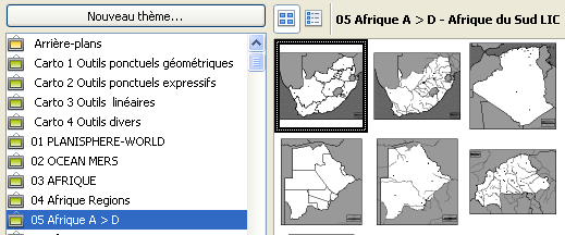
Afrique A > D |
25 |
|
|
6 |
Afrique E > G |
17 |
|
|
7 |
Afrique H > M |
22 |
|
|
8 |
Afrique N > Z |
35 |
|
|
9 |
AMERIQUE |
8 |
|
|
10 |
Amérique régions |
18 |
|
|
11 |
Amérique A >D |
29 |
|
|
12 |
Amérique E >V |
32 |
|
|
13 |
Amérique Etats Unis |
19 |
|
|
14 |
ASIE |
7 |
|
|
15 |
Asie régions |
12 |
|
|
16 |
Asie A > D |
29 |
|
|
17 |
Asie E > J |
31 |
|
|
18 |
Asie K > Y |
31 |
|
|
19 |
EUROPE |
20 |
|
|
20 |
Europe thèmes |
14 |
|
|
21 |
Europe régions |
16 |
|
|
22 |
Europe A > D |
25 |
|
|
23 |
Europe E > K |
28 |
|
|
24 |
Europe L > P |
24 |
|
|
25 |
Europe R > U |
35 |
|
|
26 |
FRANCE |
29 |
|
|
27 |
France Grands Ensembles |
10 |
|
|
28 |
France régions A > C |
38 |
|
|
29 |
France régions F> M |
35 |
|
|
30 |
France régions N > R |
30 |
|
|
31 |
France Outre Mer |
20 |
|
|
32 |
OCEANIE |
12 |
750 |
|
CARTES VECTORIELLES D'HISTOIRE |
|||
|
33 |
HIST Antiquité |
20 |
|
|
34 |
HIST V° - XV° |
15 |
|
|
35 |
HIST XVI° - XIX° |
12 |
|
|
36 |
HIST XX° |
18 |
65 |
SOURCE de la plupart des cartes
Cartes vectorielles : Cartothèque, Daniel Dalet , professeur d'hist-géo
http://d-maps.com/
http://HISTgeo.ac-aix-marseille.fr/carto/index.htm
D'autres
sites pour récupérer des cartes :
>> OOOo
accepte la quasi totalité de fichiers vectoriels (doc et wmf) et bitmap
(gif et jpg et png)
Quelques
adresses avec téléchargement gratuit : Il s ‘agit, le plus souvent,
de sites d’enseignants d’histoire-géographie
VECTORIEL (wmf ou .doc)
-Cartothèque ( près de 3000 fonds de cartes !): http://histgeo.ac-aix-marseille.fr/carto/index.htm
-Site académique d’Orléans Tours: http://www.ac-orleans-tours.fr/hist-geo-carto/cartograb.htm
-GECH d’Eric Dromer http://perso.wanadoo.fr/gech/index.htm
-F Monthe (format dsf ou gif) http://perso.club-internet.fr/fmonthe/cartographie.htm
-JF Bradu http://jfbradu2.free.fr/cartesvect/index.htm
-Espace terminales d’E Brunet http://www.ac-nantes.fr/peda/disc/histgeo/pedago/atlas-t/index.htm
-Mylène Lallement http://perso.wanadoo.fr/ch.mym.lallement/
-Site de Luc Rehmet
BITMAP (gif ou jpeg)
-Atlas d’A Houot http://perso.wanadoo.fr/alain.houot/index.html
-F Monthe http://perso.club-internet.fr/fmonthe/cartographie.htm
-Sciences Po http://www.sciences-po.fr/cartographie/
-Perry Castaneda (en anglais) http://www.lib.utexas.edu/Libs/PCL/Map_collection/Map_collection.html
-Hist-Geo .com http://www.hist-geo.com/Fonds-de-cartes.php
-Cartes du Monde diplomatique http://mondediplo.com/maps/
-IGN (pas généreux...) http://www.ign.fr/affiche_rubrique.asp?rbr_id=441&lng_id=FR
-Cartes et cliparts http://johan.lemarchand.free.fr/index.htm
-B Jacquet Ac de Besançon http://artic.ac-besancon.fr/histoire_geographie/BJacquet/cartographie/carto.htm
-Cartes des régions de Magnard http://www.magnard.fr/geolycee/region/accueil.htm
et si l’on échangeait... pour partager
vos nouvelles créations ?
Profiter du travail bénévole des autres,
c’est donc relativement facile... Dans le cadre d’un projet communautaire, principe
même d’OOo et de Cart’OOo, il serait vraiment souhaitable et recommandé
que les collègues et toute personne utilisatrice ayant :
- réalisé de nouveaux fonds de cartes
- modifié et amélioré les fonds proposés (échelle,
relief, agglomérations ajoutées ...)
les partagent avec la communauté des utilisateurs d’Open Office en les
communiquant à l’auteur de ce didacticiel qui les intégrera dans
les versions ultérieures.
S’il s’agit de faire partager quelques cartes, il suffit
d’envoyer en pièce jointe le fichier .sxw ou .sxd contenant les dessins
des cartes.
Merci à l’avance :-))